

They became lost near the Livigno Olympic site as night fell and survived freezing temperatures until rescue teams found them. They provided GPS coordinates, and thermal-imaging drones guided Alpine rescuers to their precise location, allowing both Americans to be recovered in good health.
As you follow the story, learn how quick coordination between local fire and rescue services, the Alpine Rescue Corps, and drone teams turned a dangerous overnight ordeal into a successful rescue. The next sections explain what happened during the rescue and what conditions and safety measures around the Olympic venue matter most for anyone venturing into nearby backcountry.

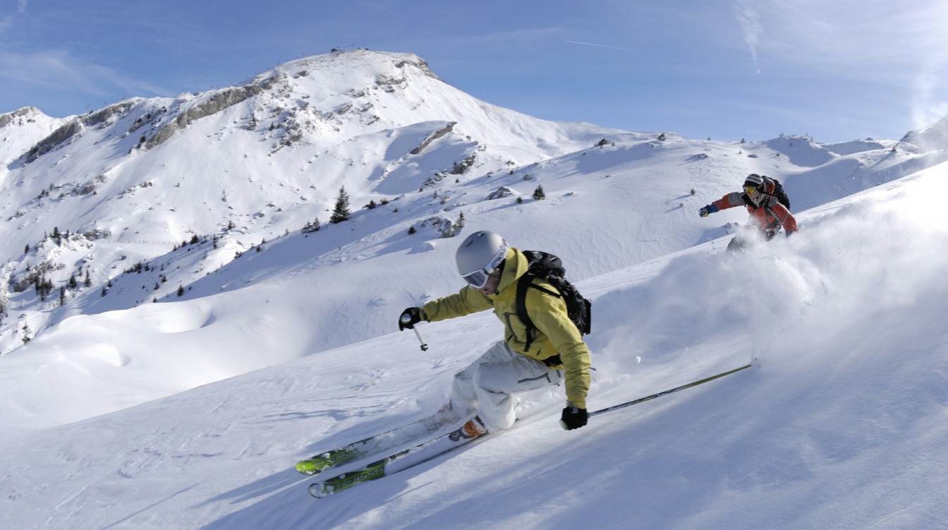
Rescue of American Skiers Near Livigno
Two American skiers became disoriented after dusk and spent the night at high altitude near Livigno. Rescue teams used the skiers’ emergency alert, GPS data, and aerial thermal imaging to locate and bring them down safely.
How the Skiers Became Stranded
The pair were backcountry skiers who left marked terrain near Livigno and lost orientation as darkness fell. They reported their situation by sending an emergency alert that included their GPS coordinates, which prevented longer search delays.
Nighttime, cold temperatures, and complex alpine terrain limited safe movement. The skiers stayed in one place after realizing they were lost, conserving energy and reducing exposure while awaiting rescue crews.
Local reports indicate they endured freezing overnight conditions but remained conscious and responsive when teams reached them. Authorities later noted both were in good health after evacuation.
Role of Vigili del Fuoco and Alpine Rescue Corps
Italy’s Vigili del Fuoco coordinated the multi-agency response and deployed specialists trained for high-altitude rescue. They worked alongside the Alpine Rescue Corps, which provided mountain-savvy technicians familiar with Livigno’s terrain.
Teams organized a targeted approach: confirm coordinates, assess weather and avalanche risk, and plan the safest extraction route. Crews used rope systems and terrain-conscious travel to reach the skiers without provoking additional hazards.
Command focused on minimizing exposure time for the victims and ensuring evacuee stabilization before transport. Medical checks followed at a lower-elevation staging area, where both skiers were evaluated and cleared.
Use of GPS Coordinates and Thermal Imaging Cameras
The skiers’ emergency alert transmitted precise GPS coordinates that narrowed the search area immediately. Rescue units cross-checked those coordinates with map data to pick initial search zones and flight paths for drones and helicopters.
Drones equipped with thermal imaging cameras flew in darkness and detected the skiers’ heat signatures against the cold alpine background. Thermal feeds gave rescuers an exact overhead view, allowing ground teams to approach from safe angles.
Thermal illumination also provided extra light during the recovery. Combining GPS coordinates with infrared imagery cut search time and reduced exposure risk for both rescuers and the two Americans.
Relevant reporting on the operation describes the drone and coordination role in the successful nighttime rescue near the Olympic venue in Livigno. (https://www.newsflare.com/video/838042/italy-drones-illuminate-night-as-american-skiers-rescued-from-alpine-peril)
Safety Measures and Conditions Around the Olympic Venue
Livigno’s emergency planning, avalanche monitoring, and patrol coordination shape how incidents are handled around Olympic sites. Rescue teams use GPS coordinates, drones with thermal imaging, and pre-established response protocols to find and recover lost or stranded people quickly.
Impact of the 2026 Winter Olympics on Rescue Protocols
The Milan Cortina 2026 preparations increased staffing and formalized response chains in Livigno. Local authorities and Olympic organizers prepositioned medical teams, search-and-rescue units, and communication liaisons to reduce activation time for incidents near competition venues.
Pre-event exercises tested interoperability between the Vigili del Fuoco, the Alpine Rescue Corps, and municipal emergency services. Those drills emphasized rapid GPS-based location sharing and drone reconnaissance to locate individuals in low-visibility conditions.
Formal agreements with nearby hospitals and helicopter evacuation services shortened patient-transfer times. That network reduced logistical friction when crews needed to operate at high altitude or in darkness.
Avalanche Risk and Unstable Snowpack
Recent heavy snowfall produced layers of unconsolidated snow that increased the likelihood of slab avalanches in the region. Meteorologists and the Alpine Rescue Corps routinely publish avalanche bulletins for Livigno and surrounding areas, listing danger levels, affected elevations, and recommended avoidance zones.
Field teams perform snowpack stability tests—such as compression and extended column tests—on slopes near off-piste routes used by backcountry skiers. Skiers are advised to carry transceivers, probes, shovels, and to travel with partners trained in rescue techniques.
Authorities restrict access to high-risk slopes when instability rises and mark managed pistes as safe; they also stress that Olympic-managed venues maintain continuous monitoring and mitigation measures.
Statements by Federico Catania
Federico Catania, spokesperson for the Alpine Rescue Corps, has highlighted the contrast between managed resort safety and the higher hazards of backcountry terrain. He noted that Olympic sites receive constant monitoring, signage, and patrols, which lowers risk for on-piste athletes and visitors.
Catania warned that fresh snowfall and unstable layers mean a single skier or natural overload can trigger avalanches on untreated slopes. He urged adherence to local bulletins and recommended using guided routes or resort-controlled areas during periods of high avalanche danger.
His comments reinforced the priority on proactive risk assessment and the value of coordination between rescue partners to respond to emergencies quickly.
General Safety for Skiers in Livigno
Skiers should check the daily avalanche bulletin and weather forecasts before leaving resort boundaries. Carrying and knowing how to use avalanche safety gear—transceiver, probe, shovel—and traveling with a partner are essential precautions.
Resort maps show managed pistes, closed areas, and recommended evacuation routes; abiding by signage and patrol advice keeps skiers within monitored zones. For backcountry travel, hiring a certified mountain guide and filing a travel plan with local authorities or mountain huts improves rescue readiness.
Drones and thermal imaging now assist night searches, but prevention through informed route choice and equipment remains the primary safety measure.
More from Vinyl and Velvet:
Leave a Reply